


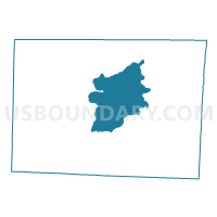
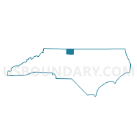
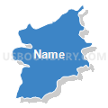
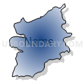
Voting District RC, Rockingham County, North Carolina
About
Outline

Summary
| Unique Area Identifier | 641297 |
| Name | Voting District RC |
| County | Rockingham County |
| State | North Carolina |
| Area (square miles) | 56.40 |
| Land Area (square miles) | 56.03 |
| Water Area (square miles) | 0.37 |
| % of Land Area | 99.34 |
| % of Water Area | 0.66 |
| Latitude of the Internal Point | 36.42301370 |
| Longtitude of the Internal Point | -79.75332240 |
Maps

Graphs
Select a template below for downloading or customizing gragh for Voting District RC, Rockingham County, North Carolina


Neighbors
Neighoring Voting District (by Name) Neighboring Voting District on the Map
- Voting District AV, Rockingham County, NC
- Voting District DR, Rockingham County, NC
- Voting District EC, Rockingham County, NC
- Voting District ED-1, Rockingham County, NC
- Voting District HO, Rockingham County, NC
- Voting District LI, Rockingham County, NC
- Voting District LK-2, Rockingham County, NC
- Voting District MA, Rockingham County, NC
- Voting District NB, Rockingham County, NC
- Voting District VA, Rockingham County, NC
Top 10 Neighboring County Subdivision (by Population) Neighboring County Subdivision on the Map
- Leaksville township, Rockingham County, NC (20,857)
- Reidsville township, Rockingham County, NC (19,874)
- Wentworth township, Rockingham County, NC (8,825)
- Mayo township, Rockingham County, NC (7,377)
- New Bethel township, Rockingham County, NC (6,703)
- Ruffin township, Rockingham County, NC (5,726)
- Simpsonville township, Rockingham County, NC (3,976)
Top 10 Neighboring Place (by Population) Neighboring Place on the Map
Top 10 Neighboring Unified School District (by Population) Neighboring Unified School District on the Map
Top 10 Neighboring State Legislative District Lower Chamber (by Population) Neighboring State Legislative District Lower Chamber on the Map
Top 10 Neighboring State Legislative District Upper Chamber (by Population) Neighboring State Legislative District Upper Chamber on the Map
Top 10 Neighboring 111th Congressional District (by Population) Neighboring 111th Congressional District on the Map
Top 10 Neighboring Census Tract (by Population) Neighboring Census Tract on the Map
- Census Tract 411, Rockingham County, NC (6,657)
- Census Tract 410.02, Rockingham County, NC (5,894)
- Census Tract 412, Rockingham County, NC (5,282)
- Census Tract 406.02, Rockingham County, NC (4,784)
- Census Tract 401.01, Rockingham County, NC (4,097)
- Census Tract 402, Rockingham County, NC (3,949)
- Census Tract 403, Rockingham County, NC (3,712)
- Census Tract 416.01, Rockingham County, NC (3,513)
- Census Tract 405.02, Rockingham County, NC (2,876)